


Long hikes through Scotland’s Highlands are hardly a new concept.
Why, as far back as 1654, the 1st Marquess of Montrose (James Graham) marched his 1,500 Royalist troops and Irish mercenaries 36 miles south to Inverlochy in 36 hours in knee-deep snow to surprise the larger and better-stationed troops of the 1st Marquess of Argyll (Archibald Campbell).
Montrose quickly routed Argyll’s men in the battle just north of Fort William — the end point of our West Highland Way trek — and chased them down this path to the spot where I am standing, about 7.5 miles south of Fort William. Argyll’s men were slaughtered, not so much in battle, but in retreat. Barely 400 of his 1,900 troops survived. Montrose lost less than a dozen.

“The Lochy river now runs red with the blood of Argyll’s finest,” lamented Diarmid Campbell, who, by the way, led “Argyll’s finest” in battle and retreat because Argyll had fallen off his horse days earlier and beat his own retreat to his galley on Loch Linne. (Argyll showed up before Parliament days later with his arm in a sling — think big white patch on an ear — and framed the slaughter as a minor setback.)
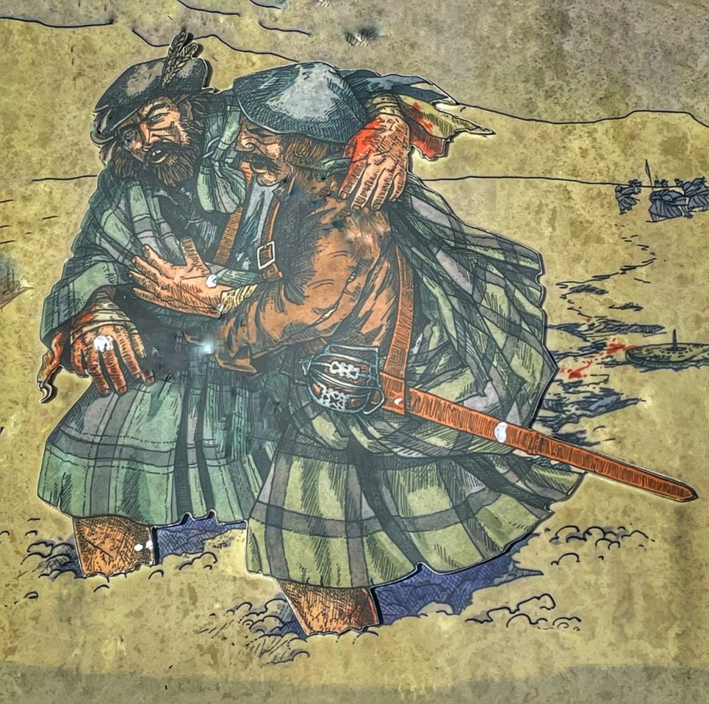
For some reason, mercy perhaps, Montrose halted the slaughter right where I am standing and let the stragglers escape. Today, there is a large pile of rocks (called a cairn) where a monument to the halted pursuit once stood. Highland hikers can add a rock to the cairn if they side with the Royalists (Montrose was backed by Charles I of England) or take one away in the name of Argyll.
I did neither. But it occurred to me that, during the last half of the last segment of my 10-day West Highland Way trek, I would be walking among the ghosts and over the bones of “Argyll’s finest.”
Now that has a way of changing perspective.
I am also dazzled by the thought of moving 1,500 troops and 50 horsemen, supplies, and weaponry over 31 miles in 31 hours. Props to Montrose. We’ve had our luggage shipped ahead each morning and this is still a challenging hike.


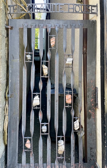
This segment, which started in Kinlochleven early this morning with a fried egg sandwich and coffee at Leven Bites, has been the most interactive of the entire trip. It starts with the gnome house on Lochaber Road. Well, not the house so much as the front yard which is filled with scores of gnomes.
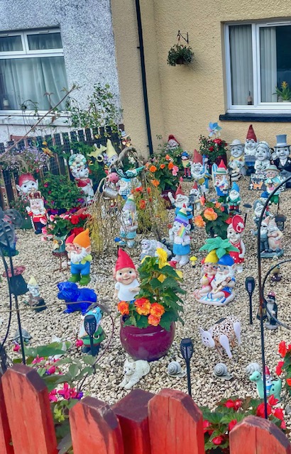
That’s the kind of thing that slows down your start. They’re irresistible little devils.
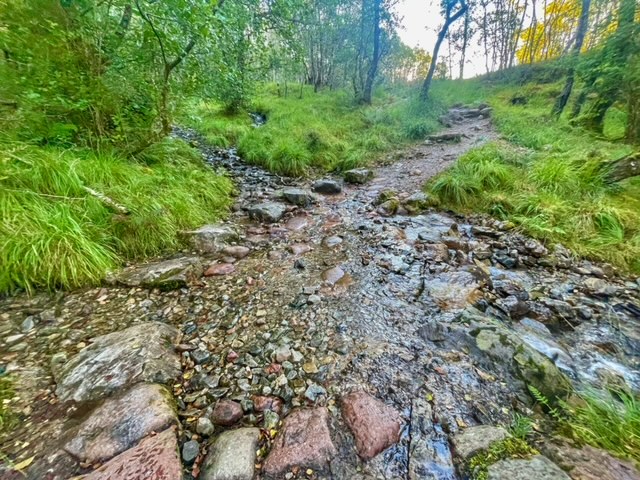
Barely 200 yards into the hike, a sign invites you to take a 20-minute detour to see the town’s marquee waterfalls. Having seen about 10,000 waterfalls during the last nine days, this one is resistable.
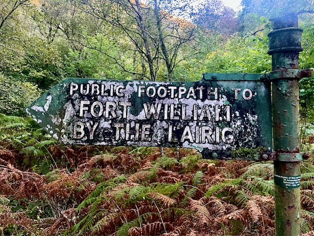
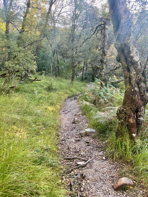
A battered sign points to the “‘Public Footpath to Fort William via the Lairig.” It doubles as the West Highland Way trail.
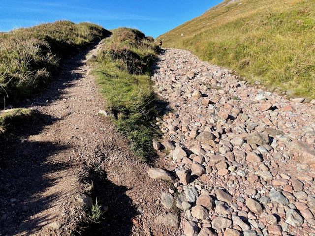
What’s a “Lairig”? From the near vertical topography through the forest, I thought it was Scottish for “incredibly steep trail.” Yes, another morning on the West Highland Way that starts with a steep climb.
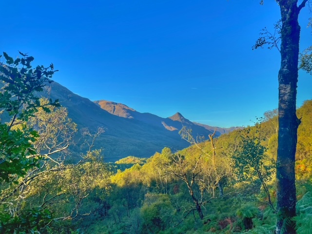
I was wrong. A “Lairig” is a mountain pass, which is what the trail became once we reached altitude and leveled off. At the apex of this climb, we could look back on the rising sun as it cast its shimmers on the wide and winding River Leven and the silhouetted Mamore mountains which served as backdrop to the whitewashed buildings of Kinlochleven.
The trail breaks through the birch and pine forest and once again appropriates the Old Military Road, a name for which I now have a greater appreciation. (I think it was the Romans who realized nations are conquered on well-built roads as much as by military strength.)


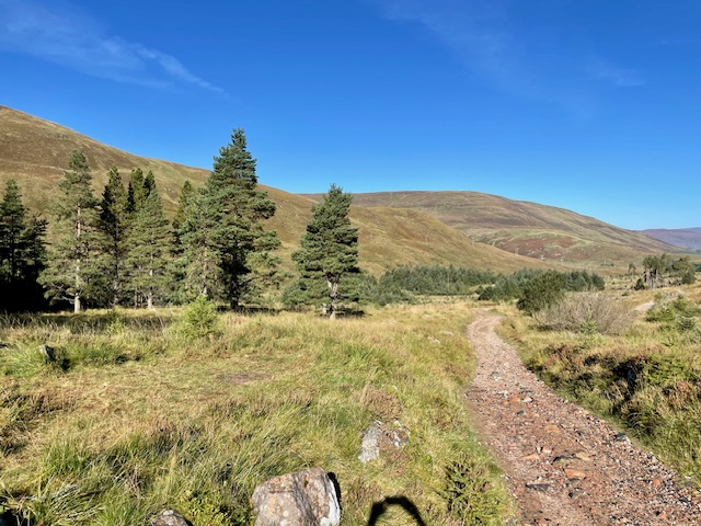
With the forest behind us, the vistas open to reveal a golden, grassy mountain pass that sweeps up to the peaks of mountains like Beinn na Caillich and Stob Ban. They are mighty and impressive but every hiker knows the one to watch for is Ben Nevis, the UK’s tallest peak and the marker that sets the end of the West Highland Way.
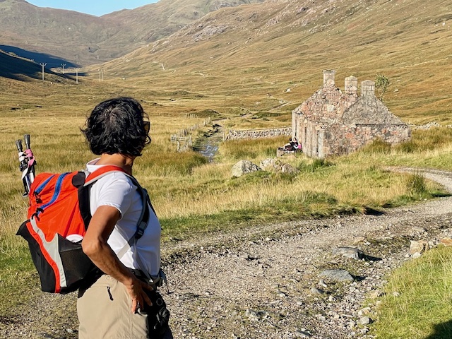
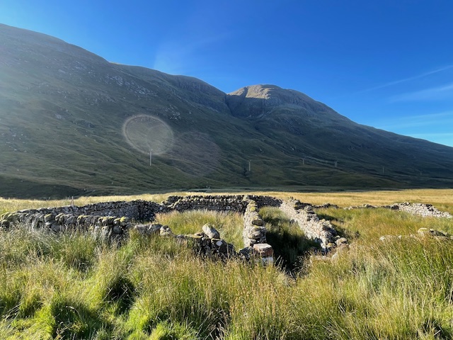
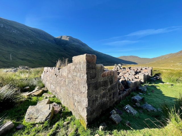
The path still climbs but ever so gradually. It is a long trek through the wide open Glen but every once in a while we pass the stone remains of winter cottages of long-gone shepherds. The crumbled foundations beg you to stop and consider the brutal winters passed in such isolation.


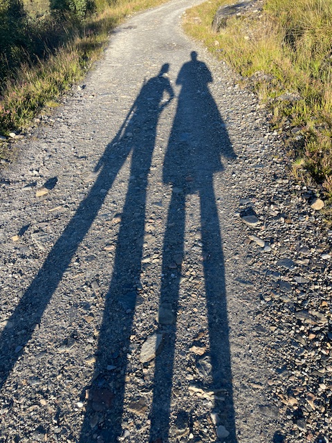
The sunlight this morning is brilliant and the sky is cloudless. Long shadows are cast before us, creating ad hoc companions for this lonely stretch.
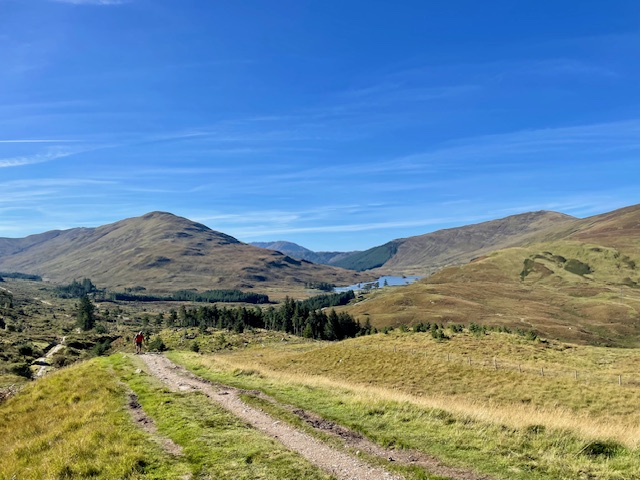
At the north end of the glen, a sheep gate signals another change in topography. The path narrows and twists and winds with the contours of the hills. We pass through stands of pine, just ahead of the Battle of Inverlocy’s cairn.

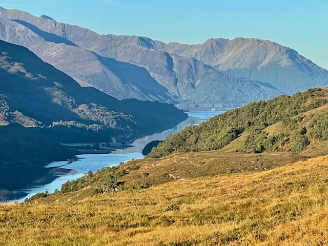
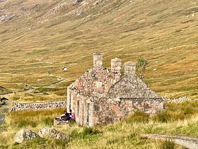
On the other side is the ruins of an old toll house which invites a respite. From this spot, the Lochan Lunn Da-Bhra looks like a tree-ringed oasis. A lone farmhouse is on the north side.
Apparently, there is an island on the far side of the Loch which was home to a rather distinguished Scotsman, MacBeth. A king’s retreat? If William raised the mythology around MacBeth to theatrical proportions, the Loch holds another mythological resident. It is believed that a “water bull” lurked below and would rise up and slaughter local livestock.
Ugh. Give me the benign and elusive Nessie any day.
The Old Military Road moves in one direction and the Way becomes a single-lane footpath following the curves and mounds of small hills.
Around one sharp curve, we are — and I apologize for the cliche but … — stopped dead in our tracks. Up ahead — far far up ahead — is the bulky and brutish form of Ben Nevis. Where other mountains soar and come to sharp peaks, Ben Nevis sits like a brown-gray bulldog (or perhaps a Shar Pei?) that refuses to be disturbed.
Different views, approaching Ben Nevis, the tallest mountain in the UK:


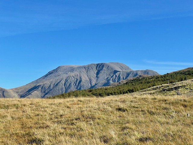


At first sighting, it does not reveal its full mass. But as we walk north, it seems to grow in strength, size, and power. There are 35,178 mountains in the UK and this one is the tallest at 4,411 feet.
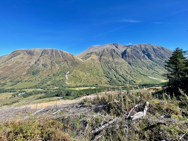
Ben Nevis shapes and defines the last five miles into Fort William. More hills, more ups and downs, more trees, more lochens, more burns, more faiery-cute waterfalls — just more of everything we have experienced over the last 96 miles. A microcosm of the entire West Highland Way.

A last steep bit of trail nearly buried in wildflowers and hikers are spit out onto a hard-packed beige gravel road that descends in lazy loops toward sea level and Fort William. The upside is pine forest. The downside drops steeply to Glen Nevis. The brute of a mountain defines the other side of the glen. It feels like a plane coming in for a landing.
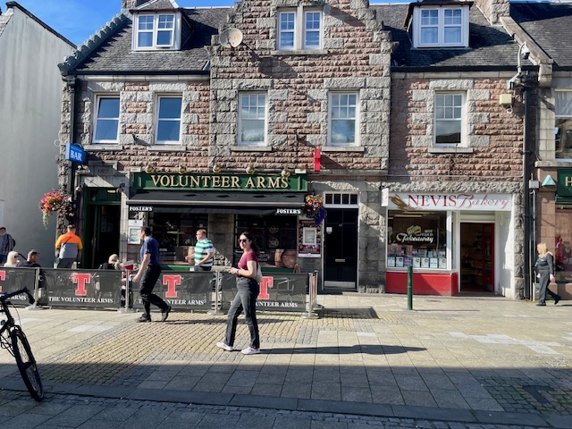
There is one last stand of ancient pines to pass through — during which I swear I heard bagpipes — which dumps out onto a busy road named, naturally enough, Glen Nevis. The final two miles are on an asphalt sidewalk which leads to a traffic circle and a row of bed and breakfast boutique hotels, all with No Vacancy signs. Wander through a rolling green park, stroll down the pedestrian-only High Street and its myriad shops, and pubs, and bistros.
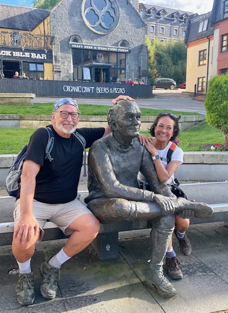
Near the end of the street is an extra-long park bench on which sits the bronze statue of a very bald and tired man whose hiking boot is off so he can rub his left foot. We’ve never met, but I feel as if I know this man.
This is the official end of the West Highland Way.
It’s a hell of a long way to walk for a photo op. But there it is.
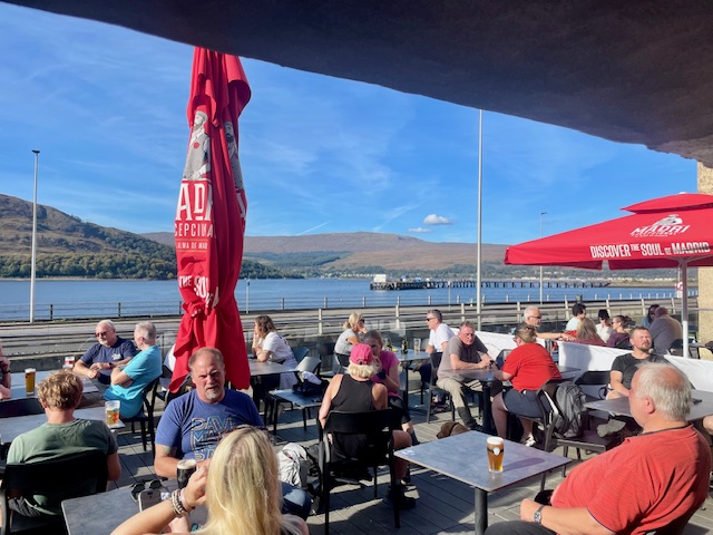
But first, I join my companions on the backside deck of — What else? — Ben Nevis Bar, overlooking Loch Linnhe. My eye is drawn to the Guinness tap, a suitable celebratory beverage, but en route, it is drawn even stronger to a bottle of Hendrick’s Gin.
Welcome to Fort William, end of the line:


Why hadn’t I thought of this before?
“A double Hendrick’s and tonic, please. With ice.”
As I sip the gin, I scan the Loch and wonder just where Archy, the 1st Marquess of Argyll (Archibald Campbell), had anchored his galley while his men were being slaughtered down the road on which I’d just walked.
Wherever it was, I’m sure it was pointed south for a quick getaway.
Soon enough, we’ll be heading to our B&B in nearby Inverlochy.
Wait. What are the chances that our house is built on the Battle of Inverlochy field?
Postscript: When I speak of the Battle of Inverlochy, I’m referring to the one in the winter of 1645. It wasn’t the first. In 1431, the Scottish monarchy forces of James I were sent packing by the troops of the Lords of the Isles.
Moving a bit into the future, I think many of the battle scenes in “Harry Potter” were filmed around here. But that is a story for another day.
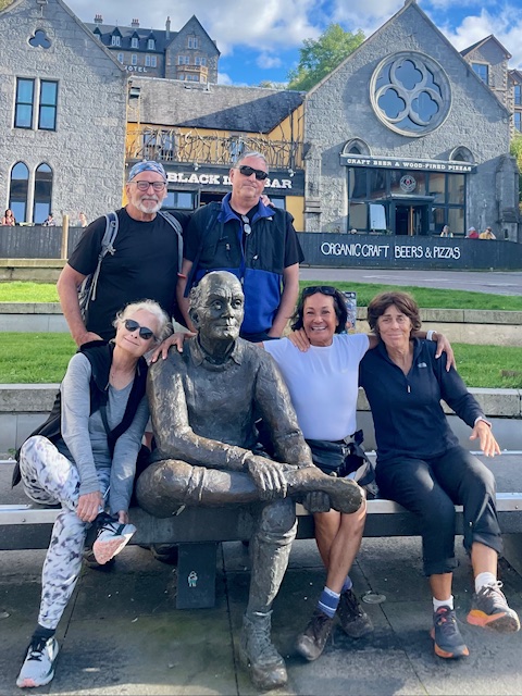
End of the line with the “tired old man statue.” Front, from left: Susan Shores, T.O.M.S., Rose Alcantara, and Kim Scholefield. In back, Brian Connors at right and yours truly:
Thank you for reading along. Please like and share with your friends. I’ll organize the stories in chronological order and connect on a single link tomorrow.

Keep enjoying these Gnomeatic Journeys! PATRICE WYNNE – PÉREZFundadora + Directora CreativaAbrazos San MiguelZacateros 24, Centro Histórico San Miguel de Allende, GTO, MX +52 415 154 8580E: SanMiguelPatrice@mac.comW: SanMiguelDesigns.comIG / FB: @AbrazosSanMiguel
LikeLiked by 1 person
Thanks for doing the trek for me.
Just reading about it was exhausting enough since I am not a hiker now at 82.
LikeLiked by 1 person
Pingback: Hiking the West Highland Way | Musings, Magic, San Miguel and More