

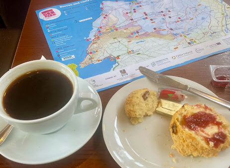
We’re In the Rock Shop Tea Room, well south of the Cliffs of Moher, an ironic place to begin a five-day hike around the rock-strewn Burren Way. Buying stones to add weight to our backpacks has no appeal but tea and scones do. And, I won’t kid you, it is awfully cold outside.
No need to rush into this thing.
Besides, my stomach needs to settle after riding the 350 Eireann bus along sinuous, snaky, undulating, rolling lanes for two and a half hours – essentially doing in reverse what we will attempt over the next five days.
At our table, we face the Atlantic and Hag’s Head Point as we sip coffee, tea, and scones. Sooner or later, we’ll have to step out the door and step onto the trail.
The hike begins across the road, walking out to a peninsula, called Hag’s Head. You can see her profile if you squint. It marks the start of the Cliffs of Moher for many, though it is perhaps 5 kilometers south.
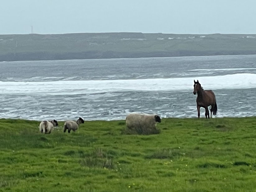
So, off we go. We sing, we dance, we hug, we pose for pictures, we talk with the sheep and cows, admire some horses, admire the Atlantic Ocean, comment on the brisk and chilling wind, pass an outcropping that looks like the head of a hag, enter a farmer’s field and …
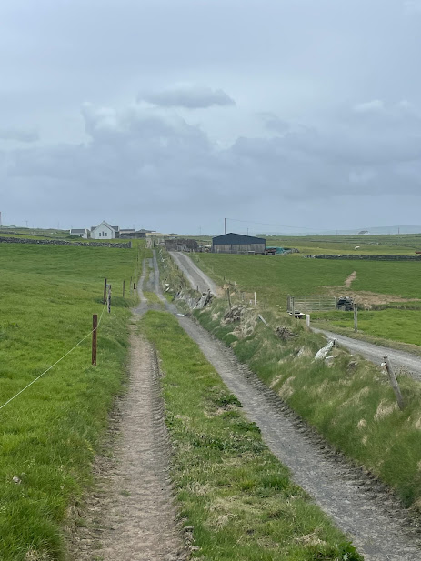
Getting to the start is half the fun …


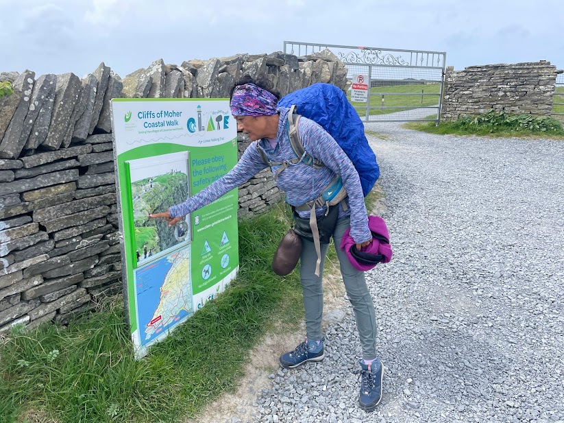

… we’re lost.
The road ends abruptly in the middle of a field. There are foreboding electric fences atop stone walls on the horizon and fields beyond with large farm animals grazing. Animals that probably wouldn’t be kind to intruders.
But off in the hazy distance, we can see the tip of the Norman watchtower that marks the beginning of the Cliffs of Moher.
Maybe the road where all the cars were parked and people in hiking gear were assembling …
So we backtrack. Not as cheerful as we once were, but not beaten down and now keenly aware of the trail and its every possible turn. Fortunately, once on track, it is mostly a matter of keeping the Atlantic to our left.
You could almost feel their contempt as we backtracked …


The unplanned excursion adds maybe an hour and a half to the day’s total. Could have been worse. We could have started farther south, say Liscannor or Lahinch Beach. Now we will have walked as if we did start there, only with this extra farmland in the mix.
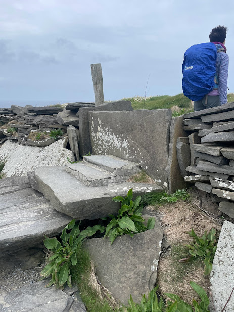
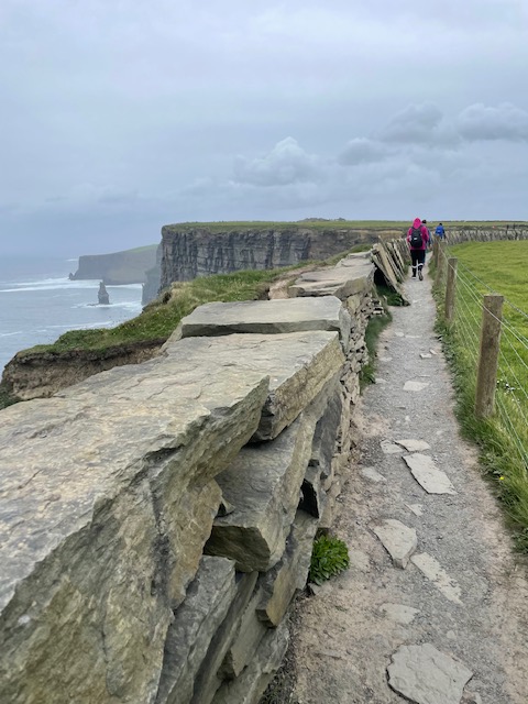
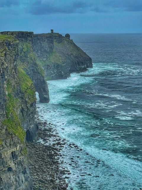
The ruins of a square, Chess-figure-like signal tower, built around 1808, during the Napoleonic War, mark the actual start of the Cliff Walk. You know it is the start because you must step over the first of many walls, gates, and fences with the aid of crude stone steps. There is a lot of stepping through fences and gates on this hike.
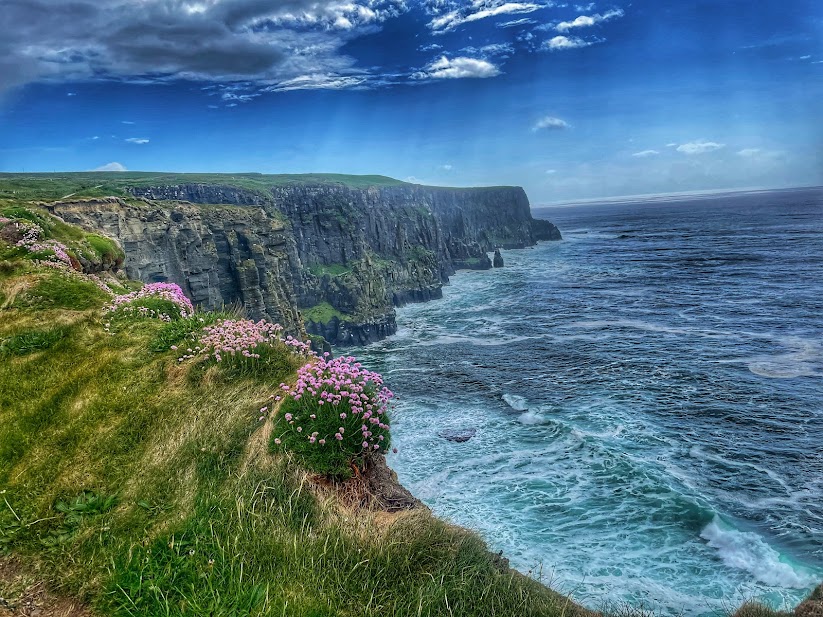
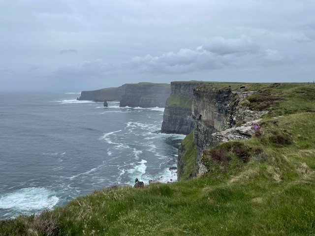
Most pictures you’ll see of the Cliffs are stunning with clear blue skies and sightlines that reach out to the curvature of the earth. But it isn’t always like that. Those pictures are most often found in Irish tourism brochures. In fact, I gather you should celebrate if you land on the cliffs on a crystal clear day.
How do you suppose those hills got so green? Frequent rain and fog, and curtains of sea haze are the banes of visitors to the Cliffs of Moher.
Our day is somewhere in between. Look, we’re walking the entire nine miles of the cliffs which means, at some point in the day, the clouds will part, the sun will shine, and we will get our holy-mother-of-god moment.
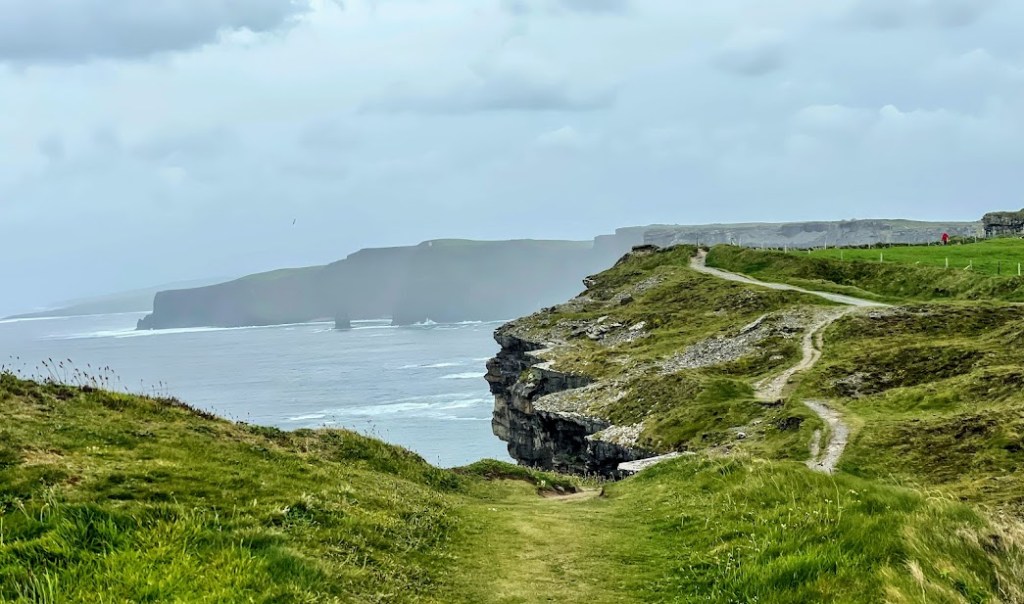
We get it several times, actually – plus some rain, and fog, and haze. The trail is a steady uphill stroll on well-defined paths and an equally steady descent into Doolin. The cliffs right beside you add a thrilling dimension to the walk.
Actually, it is a thrill ride and a half. In very slow – walking, actually – motion. Almost as thrilling as watching the people who hop the low wall to grab selfies as precariously close to the edge as possible. So worth the hits, I guess.
Cliffs of Moher from the south side of the Information Center:


Meanwhile, at the visitors center with its museum, restaurant (delicious soup and bread, by the way), trinket shops, ample bathrooms, and lookout points is a frantic ebb and flow of tour bus disgorgements.
Feel for them.
They have maybe a half-hour to an hour to hit the head, walk up the steep incline to the 702-foot alpha cliff just north of O’Brien’s Tower, grab the same stunning photo, grab a bite to eat and a Cliffs of Moher T-shirt, and run back to the bus for the ride to the next splendid Irish heritage site.
There’s a reason it looks like everyone takes the same five photographs of the Cliffs.
On the road to Doolin, north of the Cliffs of Moher:
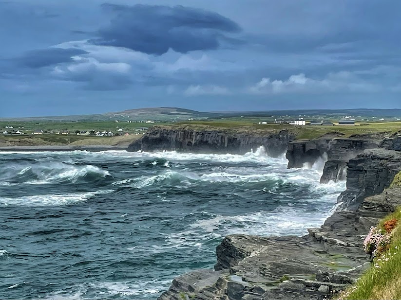
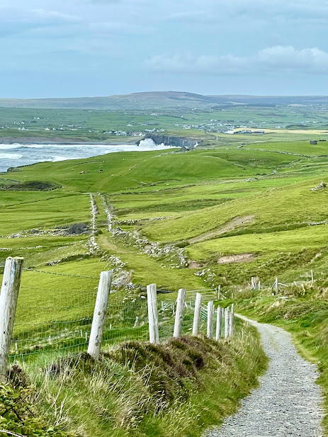


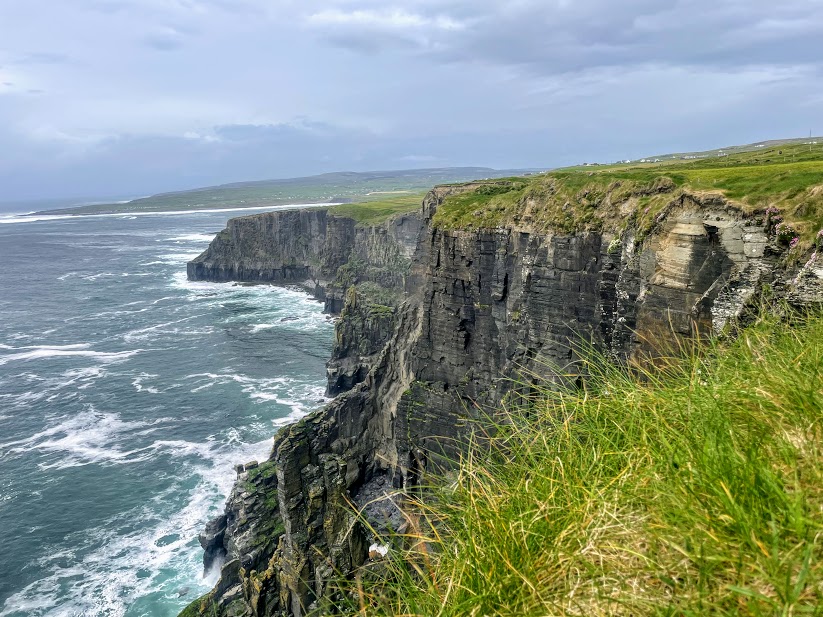
If the Cliffs were a nine-mile-long snake, the visitors center is the digestive bulge in the middle. To either side, we ran into only a handful of other hikers. Mostly we had the scenic vistas, breathtaking drops, and grassy trails to ourselves.
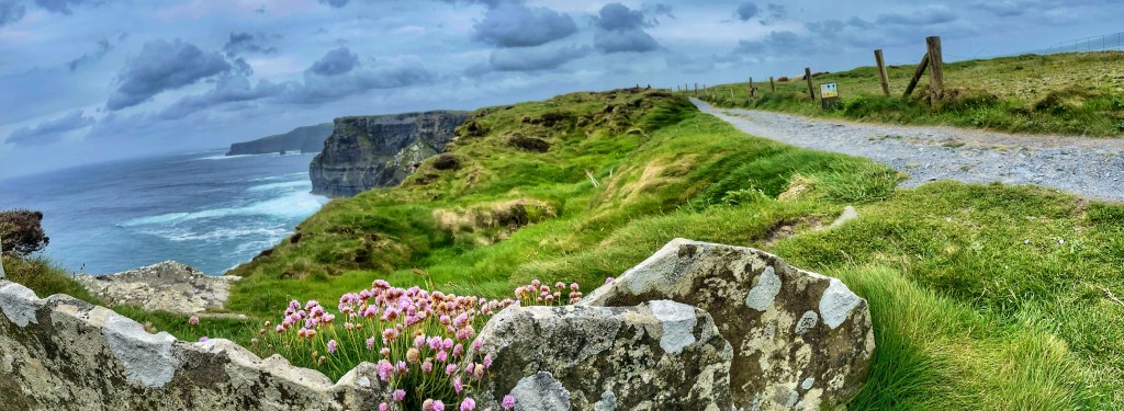
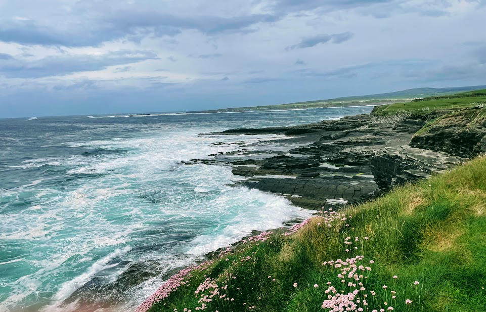
Possibly the most spectacular sight comes as you near the town of Doolin, our destination for the night. We walk through ancient fields and over stone fences on grassy paths lined with a rainbow’s worth of wildflowers.
In the distance is the little village of Doolin, four miles more of walking. But well before that, the lingering remnants of the Cliffs still rise steeply, though not so high as before. The roiling ocean waves slam into the cliffs here, crest after crest after crest, sending frothy spray straight up like a volcanic eruption. At times it soars 20 feet above the cliffs and the stiff breeze sends the cooling spray into our faces.
You won’t get that from a tour bus.

It is the energy we need for the final trek to town.
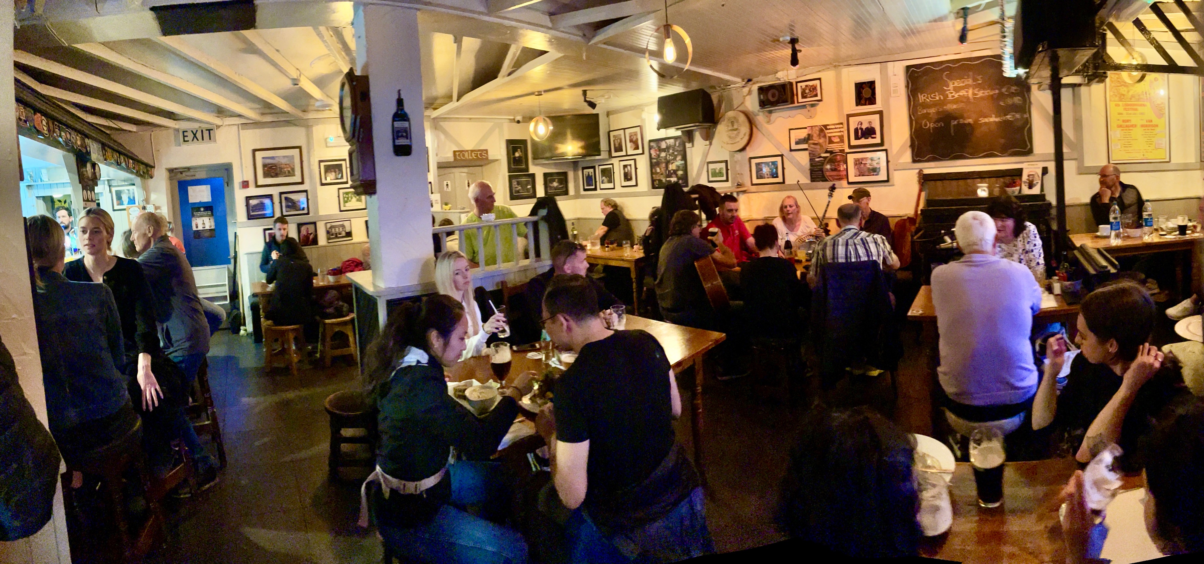
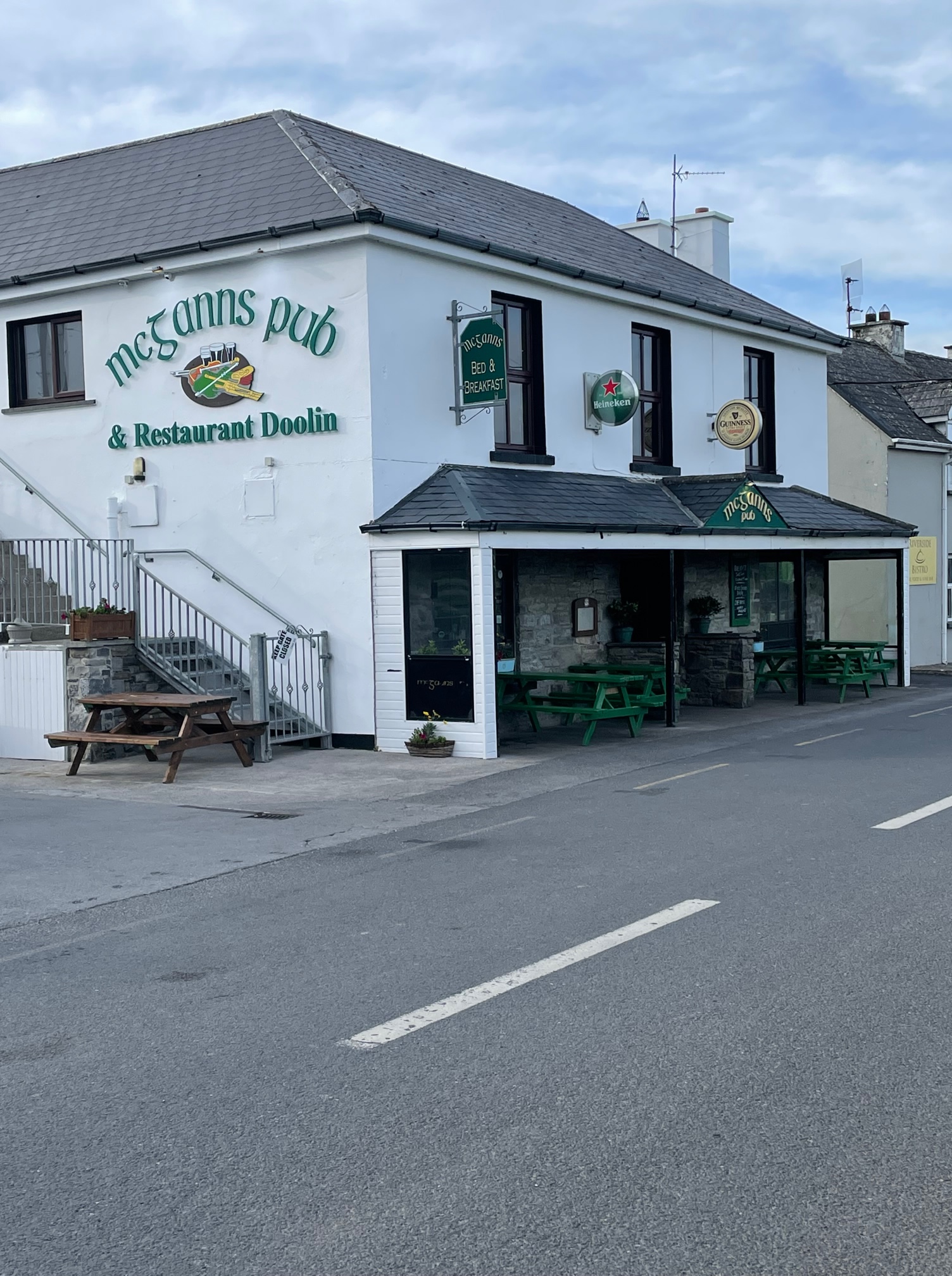
Our destination for the night is the 300-year-old Aille River Hostel Lodge and Campground. Trust me, it has been updated and upgraded numerous times over the centuries. It is positioned mid-way between the several pubs that have grown famous for hosting nightly Gaelic music jam sessions, or craics — Gus O’Connors toward the ocean, Fitzpatrick’s across the street, and McGann’s and McDermott’s a 10-minute walk to the east.
Sidewalks exist in both directions from the hostel, by the way. This seems to be a new and much-needed feature of the town.
One night in Doolin:


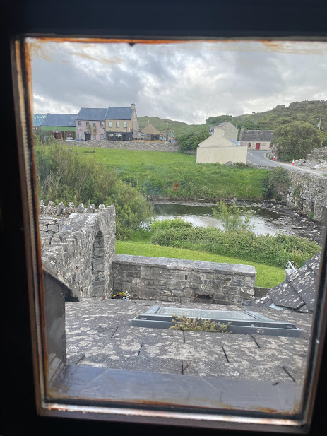

Our room is a snug one, with its own bathroom with shower and a window overlooking the verdant banks of the river. We’re there to clean up, change, and sleep on a comfortable bed so it more than suits us.
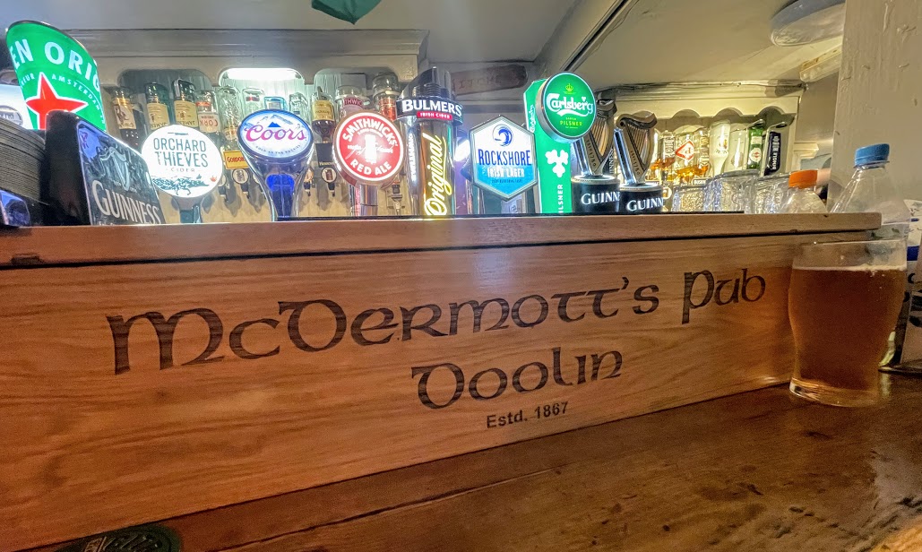
Our host, Lady, greets us warmly, warns us against a certain restaurant up the street and points us to two others with good pub food and music. We pick McDermott’s for dinner and it is packed, not a table to spare and it is only about 6 p.m.
Two stools at a short bar around the corner from the main dining room become our refuge and front row seats on the performance piece called “waiting on tables filled with impatient Americans.”
Very entertaining. The staff remains impossibly cool throughout the night. “We do this every night,” explains one, nerves of steel forged in the fire, since 1867.
We enjoy a hearty meal — lamb shank with mashed and veggies — and take in the music for a while but once again, fatigue and an early morning start push us toward bed.
Back at the lodge, I talk with Lady and the owner, Bob, for a while and he offers me the use of a dryer for some of our rain-soaked clothes.
Not only an early start but … dry clothes!
Ireland and The Burren Way Series:
Living it up in Galway before hiking the Burren Way
Day 1: The Burren Way: Hag’s Head to Doolin and not fiddlin’ around
Day 2: Doolin to Fanore, flirting with the edges of the Burren
Day 3: Fanore to Ballyvaughan, up and over the Burren
Day 4: Ballyvaughan to Carran, and not walking the Burren
Day 5: Carran to Corofin “Turn right at the castle”

Pingback: Day 2, The Burren Way: Doolin to Fanore, flirting with the edges of The Burren | Musings, Magic, San Miguel and More
Pingback: Walking Ireland | Musings, Magic, San Miguel and More
Pingback: Day 4, ‘Not’ Walking the Burren: Ballyvaughan to Carran | Musings, Magic, San Miguel and More
Pingback: Sunday morning and Ennis slowly stirs awake | Musings, Magic, San Miguel and More